Product
Marine Surveying
Enhance your projects with cutting-edge technology
Marine Surveying
Highlights
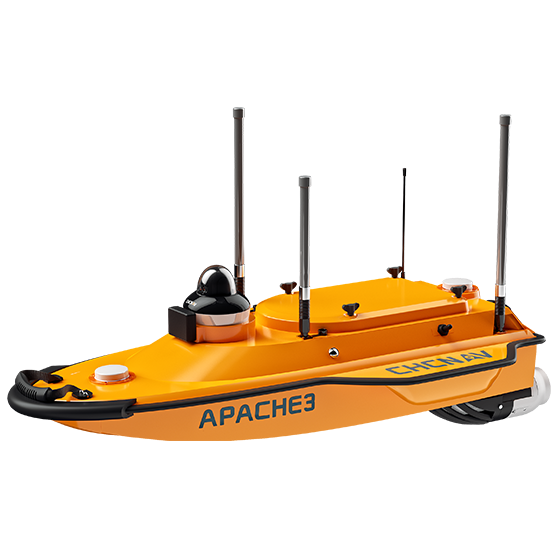
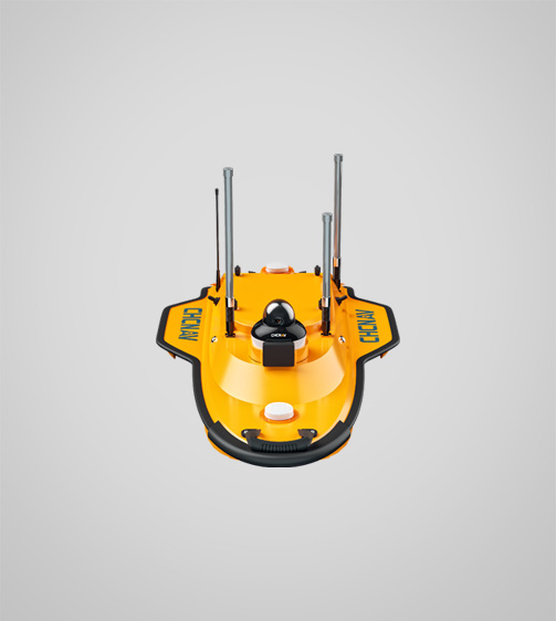
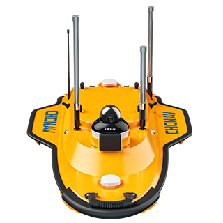
The Apache 3 is a cost-effective, portable, shallow-draft marine drone with single-beam echosounder for bathymetric surveys of lakes, inland rivers, and coastal areas. With seamless 4G communications, dual GNSS positioning and heading, an IMU sensor, and high-efficiency motors, the Apache 3 navigates pre-determined courses in autonomous mode under adverse current and flow conditions, ensuring accurate and efficient data collection.
Key Features
A durable and high-performance device designed for precision and efficiency.
Lightweight
Only 7 kg and 1 m length for easy transport and operation.
Dual GNSS Positioning
Precise positioning and heading for accurate surveys.
4G Communication
Reliable data, video, and RTCM corrections.
Android OS
Highly integrated with rich and powerful features.
Performances
Product Features and Highlights
High Performance Pocket-Hulled Vessel
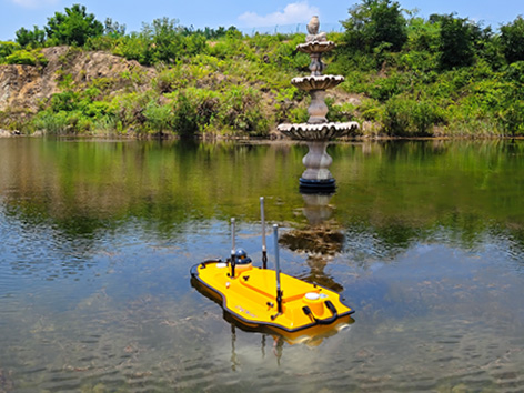
Operate in shallow waters and challenging environments with the compact design, 1 meter in length. The Apache 3 remains stable even in rapid currents, ensuring consistent data quality.
Fully Autonomous Operation
Navigate pre-determined courses with accurate linear technology and dual GNSS positioning. The Apache 3 maintains a perfect straight sailing course, even in complex current conditions.
Accurate Under Bridges
Maintain high accuracy under bridges with integrated GNSS and IMU sensors. The Apache 3 provides precise position and attitude data, compensating for hull sway and eliminating data outliers during GNSS outages.
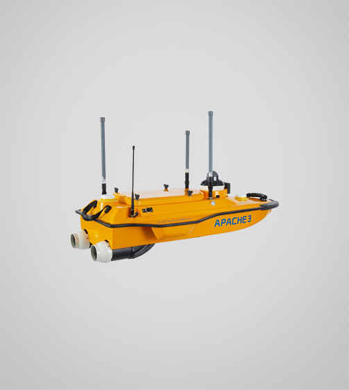
One-Man Operation
Easy to transport and deploy with just 7 kg, the Apache 3 enables a single operator to manage the project from transport to mission processing, improving operational efficiency.
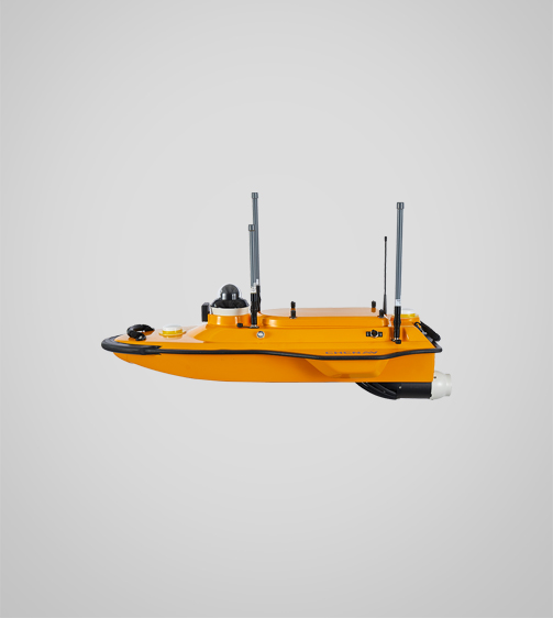
Robust and Durable Construction
Constructed with macromolecule polyester carbon fiber and Kevlar fiberglass, the Apache 3 is built for durability. The sealed straw cover and titanium alloy mesh ensure long-lasting performance in harsh environments.
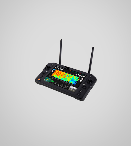
Android Intelligent Control
The integrated Android remote control supports route planning, video streaming, data collection and processing, making field operations more efficient and optimizing data transmission.
Use Cases
Applications of the Apache3
Bathymetric Surveys
Conduct detailed underwater surveys for accurate depth measurements and mapping.
Navigation Channel Surveys
Survey navigation channels to ensure safe maritime travel and optimal routing.
Riverbed Mapping
Create detailed maps of riverbeds for environmental studies and flood prevention.
Specifications
Product Details
-
System
Operating System: Windows
Languages: English, Chinese, Russian -
Features
Functions: Generate DOM and 3D models
File formats: Process GNSS, LiDAR, and RGB data -
Performance
Speed max.: 6 m/s
Payload capacity: 25 kg max
Draft: 10 cm
Positioning: Full GNSS + IMU -
Echosounder
Type: Single beam, 200 kHz
Range: 0.15 to 200 m
Resolution: ±0.01 m + 0.1% x D -
Sensors
Camera: 360° video
Seeking a Perfect Solution to Fit Your Needs?
Contact G-Surv Corp to create a customized precision solution tailored to meet the specific needs of your business. Let's get in touch and discuss how we can assist you.
Our Clients
Trusted by Leading Companies


 G-Surv Corp
Address
40 Visayas Ave, Diliman, Quezon City, Metro Manila
Call Us
+63 927 929 1674 |+63 968 860 9025
Email Us
gsurvcorp@gmail.com