Product
Software
Enhance your projects with cutting-edge technology
Software
Highlights
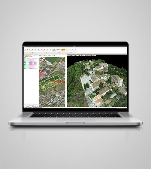
CoPre is a comprehensive LiDAR processing software developed by CHCNAV for efficient and accurate mobile geospatial data processing. It offers a range of functionalities, including trajectory processing, point cloud and image georeferencing, colorization, filtering, and Digital Ortho Model (DOM) generation. CoPre supports all CHCNAV LiDAR systems and enhances the quality and accuracy of post-processing tasks, making it an indispensable tool for geospatial professionals.

Key Features
A durable and high-performance device designed for precision and efficiency.
Advanced Algorithms
Static, fast static, PPK, and PPP GNSS processing.
Intuitive Interface
Customizable interface for seamless workflow.
Automated Processing
Point cloud, image georeferencing, colorization, and result output.
Advanced Reconstruction
DOM generation and 3D model export.
Performances
Product Features and Highlights
Comprehensive Pre-Processing
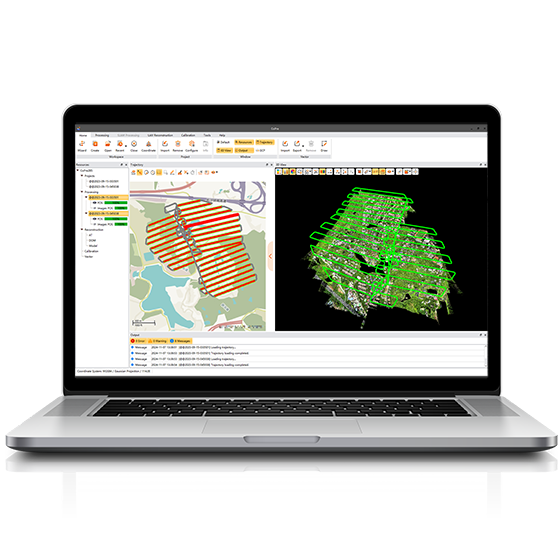
Process trajectory files, LiDAR data, and RGB images efficiently. CoPre uses a proprietary algorithm for accurate and efficient trajectory generation, supporting multiple data sets simultaneously to increase workflow efficiency.
Advanced Calibration and Optimization
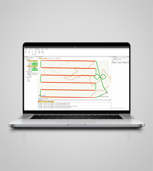
Enhance data quality with advanced calibration and optimization technologies. CoPre reduces point cloud thickness by 30% compared to similar products, using efficient strip adjustment algorithms and ground control points (GCP) for improved absolute accuracy.
Efficient Data Visualization
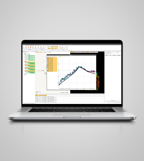
Visualize and colorize massive data sets with powerful options. CoPre’s automatic trajectory slicing and stratification checking quickly detect misalignments, while elevation accuracy is verified using imported control points.

Automated Processing Workflow
Streamline data processing with automated point cloud processing, image georeferencing, point cloud colorization, depth maps, and result output. CoPre's user-friendly interface enhances efficiency and reduces processing time.
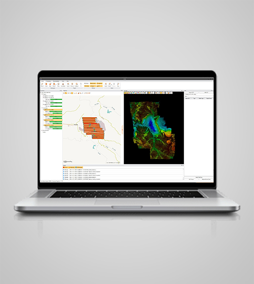
Advanced Reconstruction Module
Generate high-quality Digital Ortho Models (DOM) and 3D models. CoPre supports aerial triangulation and combines photos and point clouds to export orthophotos or 3D models quickly, enhancing on-site checks and data accuracy.
Instant Access to Raw Data
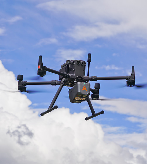
CoPre allows immediate access to raw data from all CHCNAV LiDAR systems. Whether using the compact AlphaAir 10 for UAVs or the AlphaUni 20 for helicopter corridor mapping, CoPre supports seamless data processing, ensuring efficient workflows.
Use Cases
Applications of the CoPre
Point Cloud Processing
Capture and process detailed 3D point clouds for precise measurements and analysis.
Utility Mapping
Create detailed utility maps for infrastructure management and planning.
Digital Elevation Model (DEM) Creation
Generate accurate DEMs for terrain analysis and modeling.
Contour Mapping
Create detailed contour maps for topographic analysis and planning.
Specifications
Product Details
-
System
Operating System: Windows
Languages: English, Chinese, Russian -
Features
Functions: Generate DOM and 3D models
File formats: Process GNSS, LiDAR, and RGB data

Seeking a Perfect Solution to Fit Your Needs?
Contact G-Surv Corp to create a customized precision solution tailored to meet the specific needs of your business. Let's get in touch and discuss how we can assist you.
Our Clients
Trusted by Leading Companies


 G-Surv Corp
Address
40 Visayas Ave, Diliman, Quezon City, Metro Manila
Call Us
+63 927 929 1674 |+63 968 860 9025
Email Us
gsurvcorp@gmail.com