Product
3d Mobile Mapping
Enhance your projects with cutting-edge technology
3d Mobile Mapping
Highlights
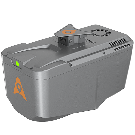
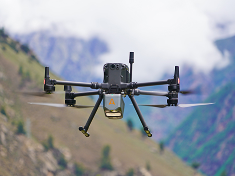
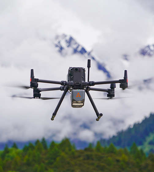
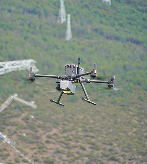
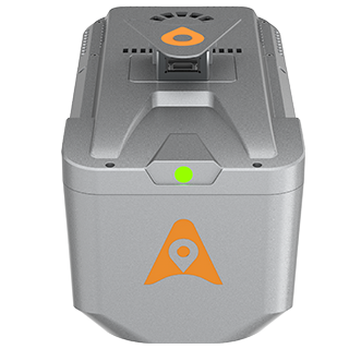
The AlphaAir 10 is a professional airborne LiDAR+RGB system designed to meet the demanding requirements of UAV LiDAR mapping and drone photogrammetry. This advanced solution integrates superior LiDAR technology with accurate GNSS positioning, IMU orientation, and a professional full frame orthophoto camera. Together with CHCNAV's point cloud and image fusion modeling software, the AA10 delivers survey-grade accuracy, efficiency, and cost-effectiveness in 3D data acquisition and processing.
Main Features
Product Details
- High-Precision LiDAR: 5 mm repeated range and 2-5 cm absolute accuracy.
- 45 MP Camera: Integrated full-frame orthographic camera.
- Lightweight: Only 1.55 kg for easy UAV integration.
Performances
Product Features and Highlights
High-Precision LiDAR Integration
Achieve unmatched accuracy with our high-precision LiDAR technology, offering 5 mm repeated range accuracy and 2-5 cm absolute precision. Enhance your mapping projects with reliable, detailed data even in complex environments.
Long-Range Scanning Capability
Extend your survey range with up to 800 m measurements and 500,000 points per second scanning. Cover large areas efficiently and with high detail, maximizing survey productivity.
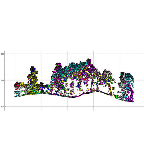
Enhanced Vegetation Penetration
Utilize advanced multi-target capabilities with up to 8 target echoes, enabling effective penetration of dense vegetation. Create accurate DEMs and DSMs in challenging environments with improved ground surface acquisition.
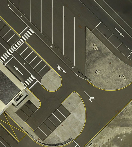
High-Resolution Imaging
Capture detailed imagery with the integrated 45 MP orthographic camera. Generate high-resolution point clouds and orthomosaic outputs for superior 3D model reconstruction and realistic textures.
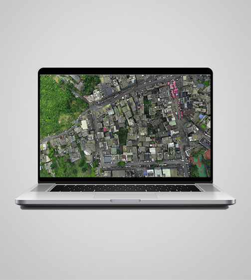
Efficient Workflow Integration
Streamline your 3D data acquisition with CoPre and CoProcess software, facilitating post-processing and feature extraction. Achieve high-quality results with an easy-to-use, efficient workflow from data collection to final output.
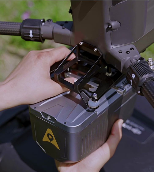
Lightweight and Versatile Design
Benefit from a compact, lightweight system (1.55 kg) that is easy to mount on various UAVs. Enjoy simplified installation with Alphaport’s one-click connection, enhancing operational flexibility.
Use Cases
Applications of the AlphaAir 10
Digital Elevation Model Generation
High-resolution elevation models for terrain analysis and geospatial applications.
Forest Canopy Mapping
Detailed canopy mapping for environmental monitoring, conservation, and carbon assessment.
Mining Site Surveys
Accurate surveying and monitoring of mining operations for safety and efficiency.
Specifications
Product Details
-
Laser Scanner
Range: 800 m
Scanning rate: 500,000 pulses/sec
Field of view: 75°
Returns: Up to 8 -
Positioning
GNSS: Full GNSS
IMU: 500 Hz
Precision max.: < 5 cm H / < 5 cm V -
Imaging
Resolution: 45 MP
Focal length: 21 mm -
Sensors
Camera: Optional external camera
Seeking a Perfect Solution to Fit Your Needs?
Contact G-Surv Corp to create a customized precision solution tailored to meet the specific needs of your business. Let's get in touch and discuss how we can assist you.
Our Clients
Trusted by Leading Companies


 G-Surv Corp
Address
40 Visayas Ave, Diliman, Quezon City, Metro Manila
Call Us
+63 927 929 1674 |+63 968 860 9025
Email Us
gsurvcorp@gmail.com