Product
Surveying & Mapping Software
Enhance your projects with cutting-edge technology
Surveying & Mapping Software
Highlights
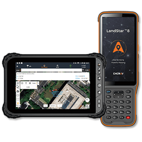
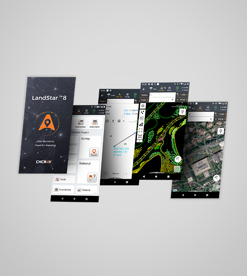
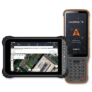
LandStar 8 is a trusted data collection app for Android devices and CHCNAV controllers, streamlining high-precision surveying and mapping with easy-to-use workflows and an intuitive graphical interface. It includes all necessary surveying functions such as construction surveying, control point measurements, CAD support, and efficient stakeout of points, lines, and surfaces. Compatible with industry-standard data formats for seamless import and export, LandStar 8 ensures immediate productivity gains.
Key Features
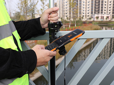
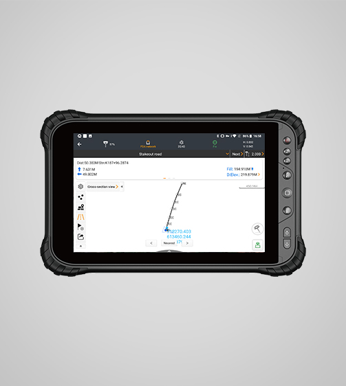
A durable and high-performance device designed for precision and efficiency.
MetaCAD Engine
Open DWG and DXF base maps fast and with smoother rendering.
Cloud Connectivity
Project backup, collaborative work, and remote support.
Modular
Customizable user interface for ease-of-use.
Comprehensive
Construction surveying, CAD support, and efficient stakeout.
Performances
Product Features and Highlights
Comprehensive Surveying Features
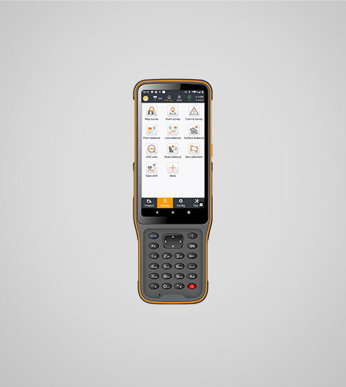
Use LandStar 8 for construction surveying, control point measurement, native CAD files support, fast and accurate point, line and surface stakeout, road construction and GIS data collection.
Advanced CAD Mapping
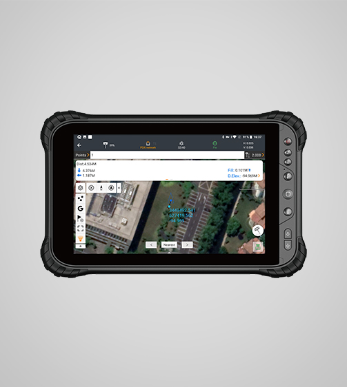
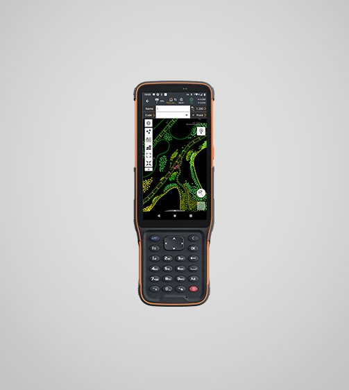
LandStar 8's proprietary MetaCAD graphics engine opens DWG and DXF files faster and with smoother rendering. The app supports DXF files up to 200 MB and smart functions like "Quick Code" automate feature coding to increase productivity.
Efficient Project Management
Get started quickly with LandStar 8's easy project setup. Copy coordinate settings, control points, and stakeout points from another controller and use coordinate systems, geoid models, and code libraries.
Enhanced Data Import/Export
LandStar 8's comprehensive import and export format support ensures seamless integration into existing software environments. The application is compatible with industry-standard data formats for easy data sharing and integration.
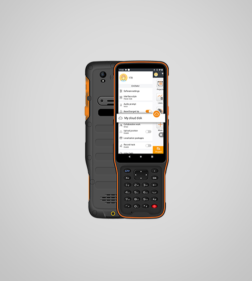
Extended Cloud Connectivity
LandStar 8's cloud-based architecture supports project backup, collaboration, data storage, and remote support capabilities, enabling efficient communication between the field and the office.
User-Friendly Interface
LandStar 8's intuitive layout makes surveying and mapping easy. Large map windows and graphics display only relevant information, hiding unused features and streamlining operations.
Use Cases
Applications of the LANDSTAR
Topographic Surveying
Measure and map terrain features with high precision.
Construction Layout
Accurately mark the boundaries and layout of construction sites.
Earthwork Volume Calculations
Calculate earthwork volumes for excavation and filling.
Road Surveys
Survey and design road infrastructure with precise data.
Cadastral Mapping
Create and update land ownership records with accuracy.
Specifications
Product Details
-
System
Operating System: Android
Languages: Over 35 supported -
Connectivity
Device: Bluetooth, Wi-Fi
Cloud: Data storage and remote support -
Interface
User menu: Customizable
Online basemaps: Google, Bing, WMS, WFS -
Features
Functions: Data collection, stakeouts and more.
File formats: SHP, DWG, DXF, KML, GPX, TIFF, JPG, MBTiles
Seeking a Perfect Solution to Fit Your Needs?
Contact G-Surv Corp to create a customized precision solution tailored to meet the specific needs of your business. Let's get in touch and discuss how we can assist you.
Our Clients
Trusted by Leading Companies


 G-Surv Corp
Address
40 Visayas Ave, Diliman, Quezon City, Metro Manila
Call Us
+63 927 929 1674 |+63 968 860 9025
Email Us
gsurvcorp@gmail.com