Product
Surveying and Engineering
Enhance your projects with cutting-edge technology
Surveying
Highlights
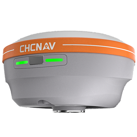
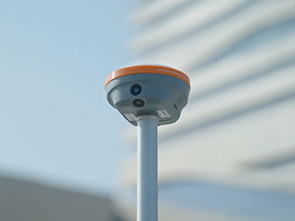
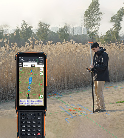
The i76 Palm Visual RTK is a lightweight receiver combining GNSS, IMU, and dual cameras. Weighing just 450g and IP68-rated, it maintains a 96% fixed rate even in areas with high solar activity. Its CAD AR visual stakeout enables precise path planning, while the 5th Gen Ultra-IMU ensures accuracy even at a 60° tilt. With over 17 hours of battery life, the i76 offers precision and adaptability for professionals seeking precision and adaptability.
Main Features
Product Details
Augmented Reality
Dual 2 MP cameras with a 95° field of view.
Superior GNSS
Reach reliable fixed RTK rate with advanced GNSS tracking.

Ultra-IMU
5th generation IMU for high accuracy and tilt compensation.
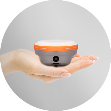
Lightweight
Extremely compact and weighing just 450g.
Performances
Product Features and Highlights
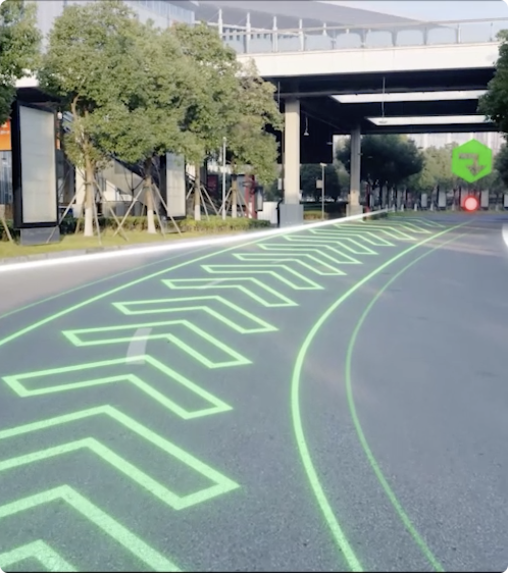
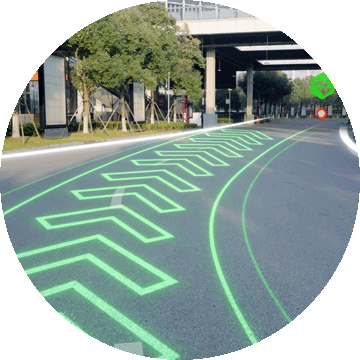
Advanced CAD Visual Stakeout
Increase overall stakeout efficiency by 40% with CAD AR visual stakeout. This technology integrates base maps with augmented reality (AR) for precise path planning and real-time visualization.
High-Precision GNSS Positioning
Achieve superior accuracy with the 4th generation air-medium GNSS antenna and iStar 2.0 technology. The i76 delivers over 96% reliable fixed RTK rate in high solar activity regions, ensuring reliable data.
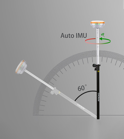
5th Generation Ultra-IMU
Enhance measurement precision by 30% with the 5th Gen Ultra-IMU. It offers automatic pole tilt compensation up to 60°, ensuring accuracy within 3 cm without manual initialization.
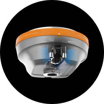
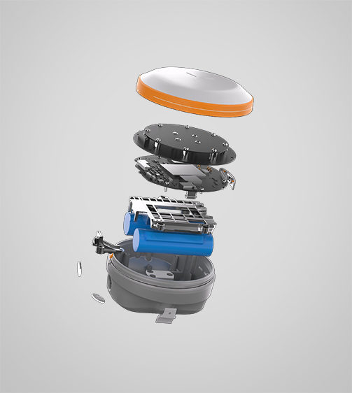
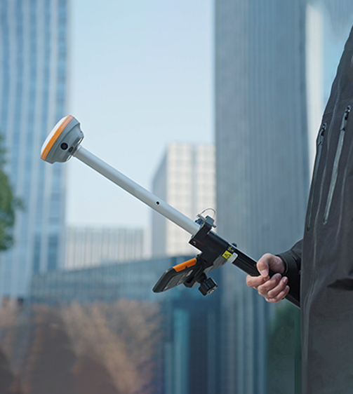
Smart Positioning System
The i76 integrates GNSS, IMU, and dual wide-angle cameras, providing a seamless surveying experience. The system supports real-time stakeout and measurement with intuitive visual feedback.
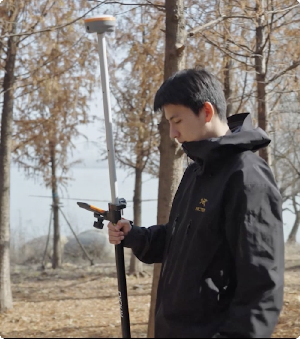
Compact and Lightweight Design
Enjoy easy handling and portability with the palm-sized i76, weighing just 450g. Its compact design makes it 40% lighter and 50% smaller than industry standards, enhancing field operations.
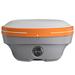
Durable and Robust Construction
Withstand harsh environments with the i76’s IP68 rating and 2-meter drop resistance. The biomimetic structure and sapphire lens ensure durability, making it ideal for tough field conditions.
Use Cases
Applications of the i76
Building Foundation Layout
Precision layout for building foundations, ensuring accurate construction and structural integrity.
Construction Site Layout
Efficient site layout and planning to streamline construction processes and ensure optimal space usage.
Stockpile Volume Measurement
Accurate measurement of stockpile volumes for resource management and material tracking.
Utility Network Mapping
Mapping utility networks for better planning, management, and maintenance of critical infrastructure.
Specifications
Product Details
-
Positioning
GNSS: Full GNSS
IMU: 200 Hz
Precision max.: 0.8 cm H / 1.5 cm V -
Sensors
Camera: Dual -
Physical
Weight: 0.450 kg
Dimensions: 106 x 55.6 mm
Battery life: Up to 17 hours RTK rover
Seeking a Perfect Solution to Fit Your Needs?
Contact G-Surv Corp to create a customized precision solution tailored to meet the specific needs of your business. Let's get in touch and discuss how we can assist you.
Our Clients
Trusted by Leading Companies


 G-Surv Corp
Address
40 Visayas Ave, Diliman, Quezon City, Metro Manila
Call Us
+63 927 929 1674 |+63 968 860 9025
Email Us
gsurvcorp@gmail.com