Product
3D Mobile Mapping
Enhance your projects with cutting-edge technology
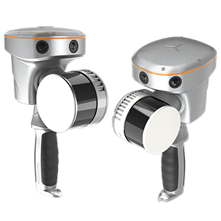
3D Mobile Mapping
Highlights
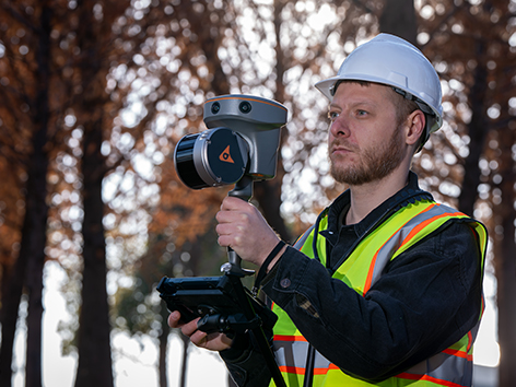
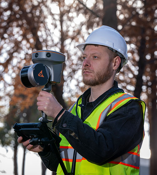
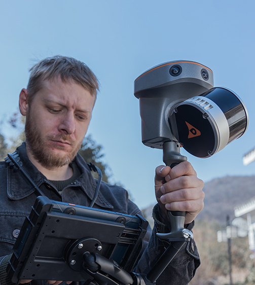
The RS10 integrates GNSS RTK, laser scanning, and visual SLAM technologies into one single platform. This fusion increases the efficiency and accuracy of both indoor and outdoor 3D scanning and surveying tasks. It gives surveyors the ability to work in areas with weak GNSS signals, providing unparalleled flexibility. Designed for surveying, BIM, forestry, power line inspection, underground mapping, and more, the RS10 embodies versatility, making it an essential tool for professionals looking to expand their surveying capabilities.
Main Features
Product Highlights
GNSS RTK + SLAM
Combine RTK, laser, and visual SLAM to achieve 5cm absolute accuracy.
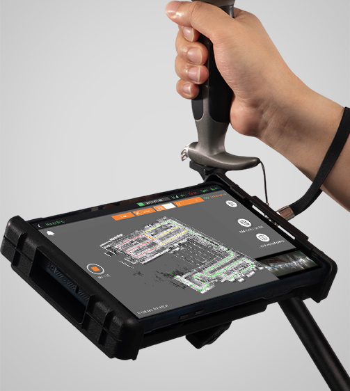
Real-Time Mapping
Real-time georeferenced point clouds in the field.
High-Precision
1 cm relative accuracy with GNSS and LiDAR technologies.
Hot-Swappable Battery
60 minutes per battery with hot-swap capability for uninterrupted operation.
Performances
Product Features and Highlights
Integrated GNSS RTK and SLAM
Combine GNSS RTK and SLAM for unparalleled flexibility. The RS10 ensures precise data collection in areas with weak or no GNSS signals, enhancing indoor and outdoor surveying accuracy.
High-Precision Measurement
Achieve 5 cm absolute measurement accuracy with the 4th generation GNSS antenna and high-precision LiDAR. The RS10 delivers reliable data for detailed architectural surveys and complex infrastructure projects.
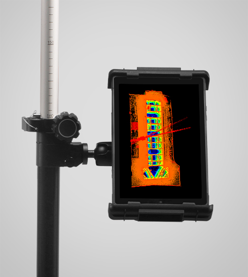
Real-Time SLAM Mapping
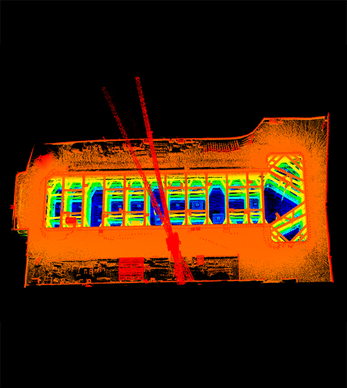
The RS10 creates georeferenced point clouds directly in the field with real-time SLAM capabilities. It provides immediate feedback on collected data, allowing for on-the-fly adjustments to ensure complete coverage.
Efficient Loop-Free Workflow
Eliminate the need for traditional loop closure with integrated GNSS and SLAM technologies to simplify field data collection and reduce project completion time and effort.
Versatile Application Support
Use the RS10 for a wide range of applications, from BIM and forestry to power line inspection and underground mapping. Its versatility makes it an invaluable tool for professionals in various fields.

Comprehensive Software Integration
The RS10 streamlines your workflow with the SmartGo and CoPre software for real-time data visualization and point cloud processing. It supports efficient and accurate data management from collection to modeling.
Durable and Lightweight Design
Operate in challenging environments with the IP64-rated, lightweight RS10. The robust design ensures reliability and ease of use in diverse conditions.
Hot-Swappable Battery
Maintain continuous operation with the hot-swappable lithium battery. The RS10 offers 60 minutes of runtime per battery, allowing for seamless replacement without powering off the unit.
Use Cases
Applications of the RS10
As-Built Surveying
Capture precise post-construction data for project verification and documentation.
Forestry & Vegetation Mapping
Monitor forest health and land cover changes with high-resolution mapping.
Utility Inspection
Inspect power lines, pipelines, and infrastructure for safety and maintenance.
Augmented Topographic Surveying
Enhance terrain mapping with real-time georeferenced point cloud technology.
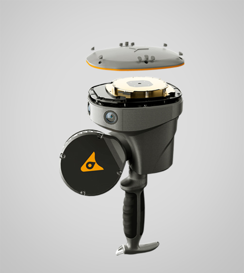
Specifications
Product Details
-
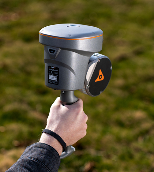
Laser Scanner
Channels: 16 or 32
Range: 120 or 300 m
Scanning Rate: 320,000 or 640,000 pulses/sec
Field of View: 210° x 170°
Returns: Up to 2 -
Positioning
GNSS: Full GNSS
Absolute Accuracy: < 5 cm H / < 5 cm V
Relative Accuracy: < 1 cm -
Sensors
Camera: 15 MP (3x 5 MP)
Seeking a Perfect Solution to Fit Your Needs?
Contact G-Surv Corp to create a customized precision solution tailored to meet the specific needs of your business. Let's get in touch and discuss how we can assist you.
Our Clients
Trusted by Leading Companies


 G-Surv Corp
Address
40 Visayas Ave, Diliman, Quezon City, Metro Manila
Call Us
+63 927 929 1674 |+63 968 860 9025
Email Us
gsurvcorp@gmail.com